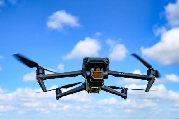
Drone Based Mapping
Drone-based survey and mapping, also known as unmanned aerial vehicle (UAV) surveying or aerial mapping, involves the use of drones equipped with cameras, sensors, and GPS technology to collect aerial imagery, geospatial data, and terrain information for various applications.
Overall, drone-based surveying and mapping offer a cost-effective, efficient, and versatile solution for collecting geospatial data, conducting surveys, and monitoring various environments and assets. The technology continues to evolve, offering new opportunities for applications across industries and disciplines. Here’s a brief overview of drone-based survey and mapping:
- Construction and Civil Engineering: In the construction and civil engineering sectors, drones are used for site surveying, progress monitoring, and quality control throughout the project lifecycle. Drones capture aerial imagery, photogrammetric data, and 3D models of construction sites, providing valuable insights into topography, earthwork volumes, site conditions, and project progress. Drone surveys help optimize site layout, plan infrastructure projects, and identify potential safety hazards or compliance issues.
- Infrastructure Inspection and Maintenance: Drones are employed for inspecting and monitoring critical infrastructure assets such as bridges, roads, railways, pipelines, and utility networks. Equipped with high-resolution cameras and sensors, drones can capture detailed imagery and detect defects, deterioration, or anomalies in infrastructure components. Drone surveys enable proactive maintenance planning, asset management, and condition assessment, helping to ensure the safety, reliability, and longevity of infrastructure systems.
- Mining and Aggregates: In the mining and aggregates industry, drones are used for aerial mapping, volumetric analysis, and stockpile management. Drones collect aerial data of mine sites, including terrain elevation, ore stockpiles, and extraction areas, allowing for accurate measurement of volumes and inventory. Drone surveys support mine planning, optimization of extraction operations, environmental monitoring, and compliance with regulatory requirements.
- Agriculture and Precision Farming: Drones play a vital role in agriculture and precision farming by providing farmers with actionable insights for crop monitoring, yield estimation, and resource management. Drones equipped with multispectral or thermal cameras capture aerial imagery of farmland, allowing for the detection of crop health issues, pest infestations, irrigation inefficiencies, and nutrient deficiencies. Drone surveys help farmers make informed decisions, optimize input usage, and maximize crop yields while minimizing environmental impact.
- Environmental Monitoring and Conservation: Drones are utilized for environmental monitoring, ecosystem mapping, and wildlife conservation efforts. Aerial surveys conducted by drones enable researchers and conservationists to monitor biodiversity, habitat change, deforestation, and natural disasters in remote or inaccessible areas. Drones equipped with specialized sensors, such as LiDAR or thermal imaging, provide valuable data for ecological research, habitat restoration, and wildlife management initiatives.
- Emergency Response and Disaster Management: Drones play a crucial role in emergency response and disaster management by rapidly assessing disaster-affected areas, conducting search and rescue operations, and providing situational awareness to emergency responders. Drones equipped with cameras and thermal sensors can survey disaster zones, identify survivors, and assess damage to infrastructure, helping authorities coordinate rescue efforts, allocate resources, and prioritize response actions.
- Real Estate and Property Development: In the real estate and property development sector, drones are used for aerial photography, videography, and 3D modeling of properties and developments. Drones capture high-resolution imagery and immersive aerial views of real estate listings, construction projects, and land parcels, enhancing marketing efforts and visualizing project designs for clients, investors, and stakeholders.
- Surveying and Mapping Services: Professional surveyors and mapping professionals utilize drones for land surveying, cadastral mapping, and geographic information system (GIS) applications. Drones equipped with GPS and survey-grade sensors can collect accurate geospatial data, including orthophotos, digital elevation models (DEMs), and point clouds. Drone surveys offer a cost-effective and efficient alternative to traditional surveying methods, particularly for large-scale or inaccessible areas.
- Construction and Contracting Services: As a full-service contracting firm, BEIT RAZAN specializes in delivering high-quality construction solutions tailored to the needs of diverse projects. From ground-breaking to project completion, our experienced team manages every aspect of the construction process with attention to detail and craftsmanship. Whether it’s new construction, renovation, or remodeling, we prioritize safety, efficiency, and quality assurance to deliver projects on time and within budget.
Types of Ariel Survey
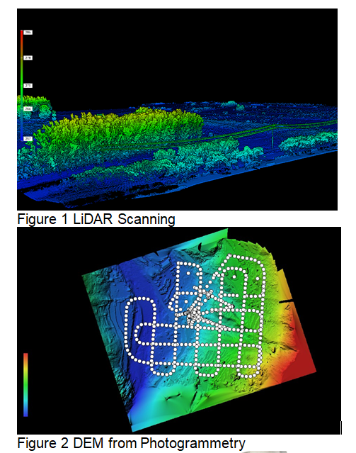
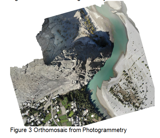
- Photogrammetry: Photogrammetry involves capturing overlapping aerial photographs of the Earth’s surface and using them to create accurate 3D models, maps, and measurements. It relies on the principles of triangulation to determine the spatial relationships between objects in the photographs.
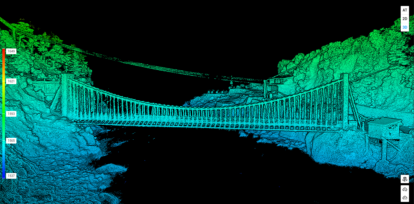
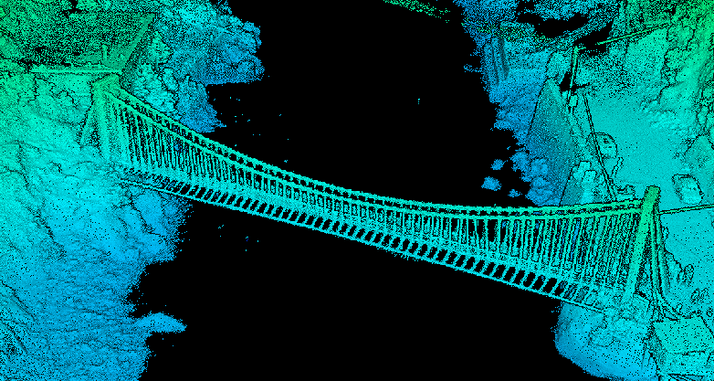
- LiDAR (Light Detection and Ranging): LiDAR technology uses laser pulses to measure distances to the Earth’s surface, enabling the generation of precise elevation data, terrain models, and 3D point clouds. LiDAR Surveys are widely used for topographic mapping, vegetation analysis, and infrastructure assessment.
- Thermal Imaging: Thermal imaging surveys capture infrared radiation emitted by objects on the Earth’s surface, providing valuable information about temperature variations, heat loss, and thermal anomalies. Thermal imaging is used in environmental monitoring, building inspections, and agricultural applications.
- Multispectral Imaging: Multispectral imaging surveys capture images of the Earth’s surface in multiple spectral bands beyond the visible spectrum, allowing for the detection and analysis of various features such as vegetation health, soil moisture, and land cover. Multispectral imaging is used in agriculture, forestry, and environmental studies.
- Hyperspectral Imaging: Hyperspectral imaging surveys capture hundreds of narrow spectral bands across the electromagnetic spectrum, enabling detailed spectral analysis and identification of materials and substances on the Earth’s surface. Hyperspectral imaging is used in mineral exploration, environmental monitoring, and precision agriculture.
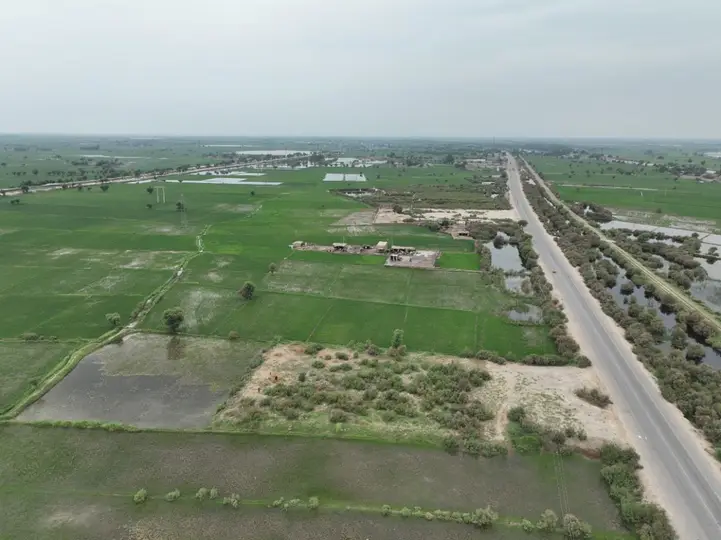
225 km Road Survey
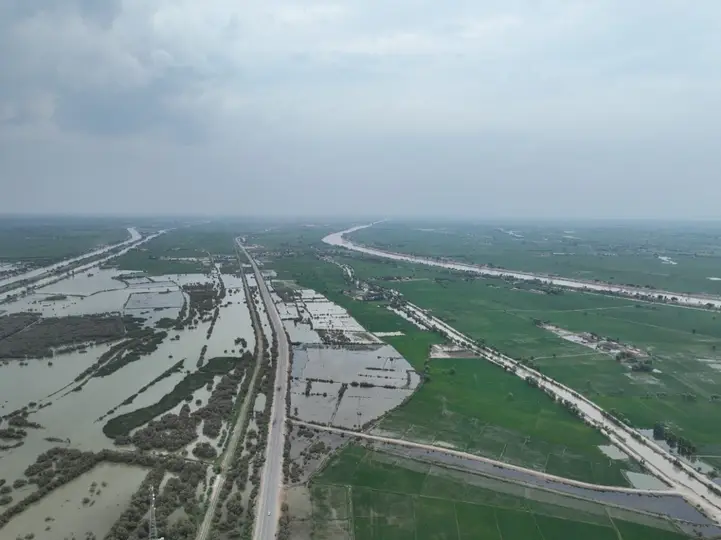
Flood monitoring using Drones
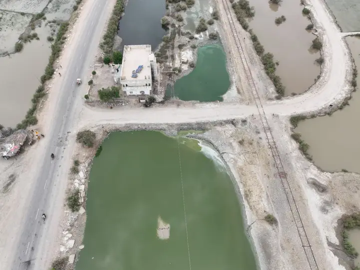
Railway and Road running parallel to each other
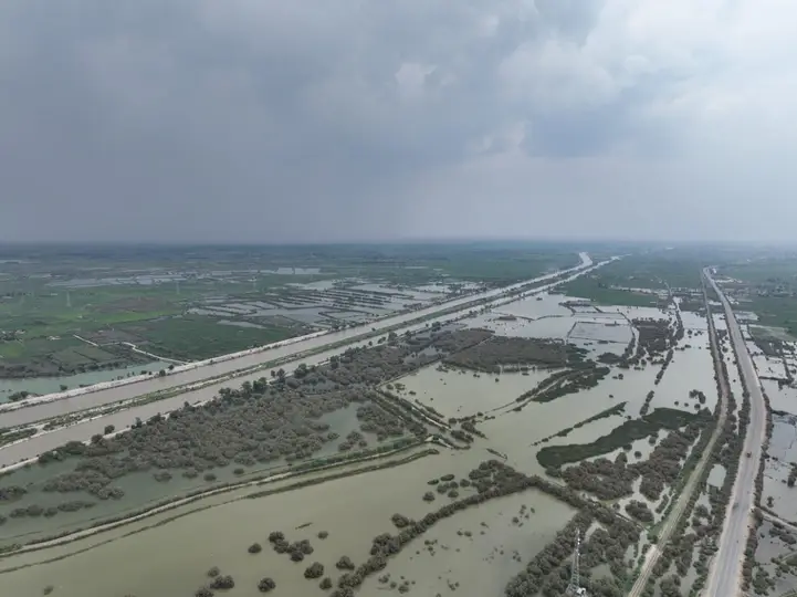
Flooded Area in Pakistan.
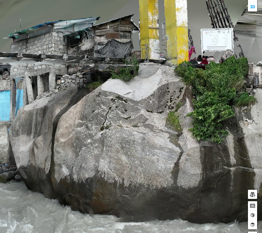
3D Model of Pylon Foundation, indicating the fissures in the rock mass
3D Model of Pylon Foundation, indicating the fissures in the rock mass